 |
 |
 |
 |
Torrente Leale 

Description:
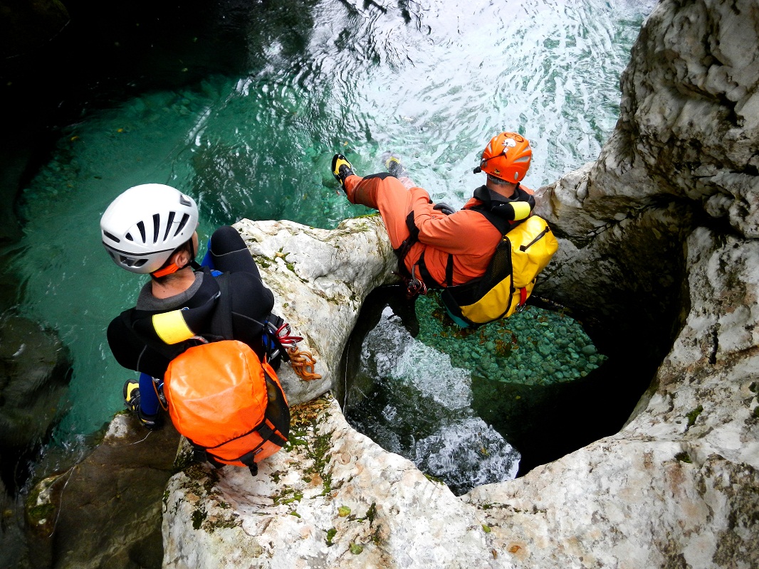
A very beautiful and technical canyon; the upstream section of the descent is not difficult but also is of limited interest from the canyoning point
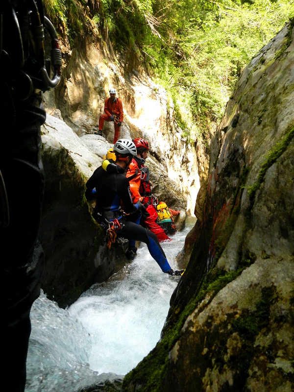
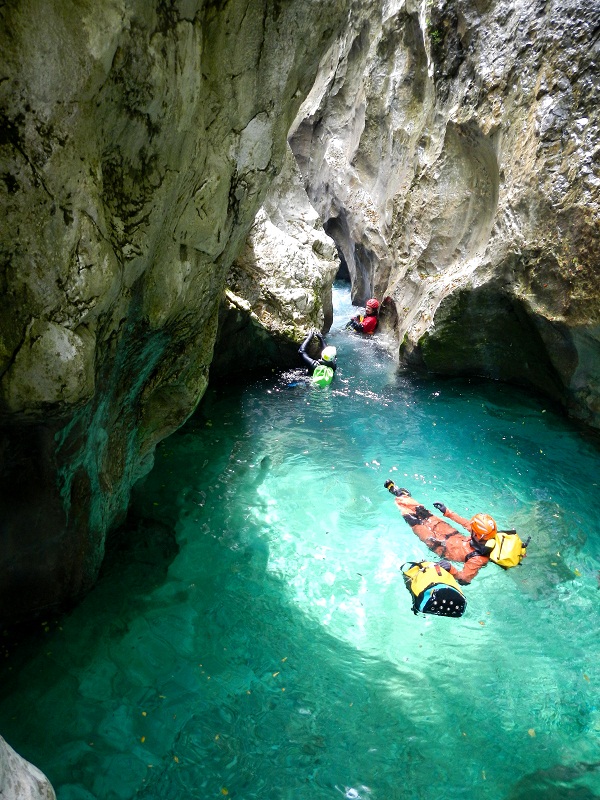
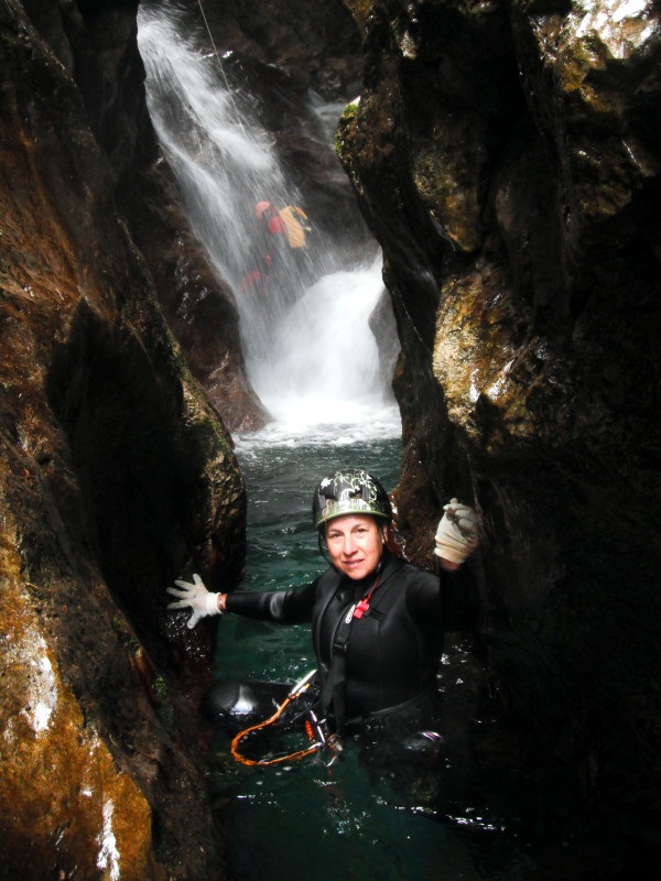
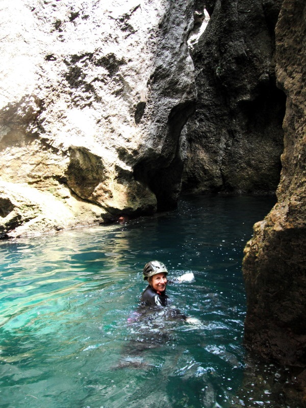
of view, while the lower section includes a very short, tight section with a descent under the flow, flooded corridors, and deep pools.Following the upper section, after a short open and flat part, the second section continues between narrow, high walls of alternating flooded meandering passages, pitches and jumps that will accompany us relentlessly to the exit.
The lower part can be linked to the Riu dal Boschet, a tributary of the Leale that enters on the left bank in the section between the two narrow passages.

Zone:
Friuli Venezia Giulia - Trasaghis (UD)Elevation and length:
Entrance: 340 mExit: 200 m
Height difference: 140 m
Length: 600 m
Highest pitch: 18 m
Advised decent period:
From May to OctoberExposure:
EastTimings:
Approach: 20 minsDescent: 2h 30 mins
Return: 10 mins
Shuttle:
About 4 KmAnchors:
Excellent ProCanyonAdvised ropes:
2 of 20 m + emergency ropeGear:
Full wetsuitEscapes:
After the first narrow section, past the large pool over the P8, in front of the tributary of riu dal Boschet, climb up the right bank for about 50
meters until you find a path that leads towards the access path.In the second section, there are no escape routes.
Map:
Carta Tabacco 1:25000 page n° 020 - Prealpi Carniche e Giulie del Gemonese or n° 018 - Alpi Carniche Orientali Canal del FerroInterest:
NationalDifficulty:
V4 a4 IVCoordinates (WGS84) for downstream (valley) parking:
46° 17' 58,97" N 13° 2' 31,25" ECoordinates (WGS84) for upstream (mountain) parking:
46° 17' 39,25" N 13° 1' 39,82" E Approach to the valley (lower car park):
From Gemona follow the signs to Trasaghis. Pass Trasaghis towards Avasinis. Enter Avasinis and follow the signs to Alesso.After leaving the village, the road is flanked on the right by a red barrier, after which the road widens with a small junction and a large panel of wood. You can park on the roadside here or opt for a more comfortable choice, taking the street (dead end) on the left side of a house.
Follow it until you reach the ford on the stream, pass over this and continue for about fifty meters. Park in some space on the side of the road before the forest.
!!!! Avoid parking near the ford and the lawn adjacent to the house just after the ford !!!!!
Approach to the mountain (upper car park) and canyon access (walking):
Go back for 1 km leaving Avasinis. Just outside the village, take an uphill road on the right signposted Monte Prat - Planecis, continue for about 3 km
until you reach a junction with a road on the right (signed 'divieto di transito'), park here.From here, continue on foot for another 500 m, passing a house on the right. The path, marked with a ProCanyon sign, starts to descend into the forest where there is a gully, just after a brief downhill section of the road .
Description and technical notes:
After a short walk and a couple of downclimbs, you reach the first narrow canyon section, easily recognizable from the siphon to the right, from where
all the water is channelled. On the left, there is the easier passage that by-passes the siphon by continuing between the walls that form a natural rock arch.This is the point at which you should make an assessment on the water level. If there is any flow here, this means that the flow will be very strong in the second narrow passage and could make a safe descent impossible.
01 - DIS 2 L - rock arch
02 - DIS 2
03 - J 2
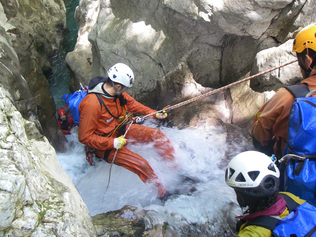
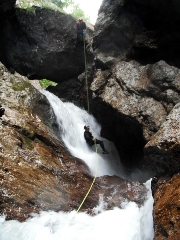
04 - MC + RB + P 6 L
05 - MC R + RB + P 8 central - possible J 8
Continue for 20 m - Tributary on river left of the Riu dal Boschet and escape route river right - Continue 50 m further
06 - P 4 R
07 - MC + P 15 L
08 - MC + 3 RB + P 15 R (2 bolts for tyrolienne available)
09 - MC + P 8 R
10 - J 2
11 - P 6 R - possible J 5
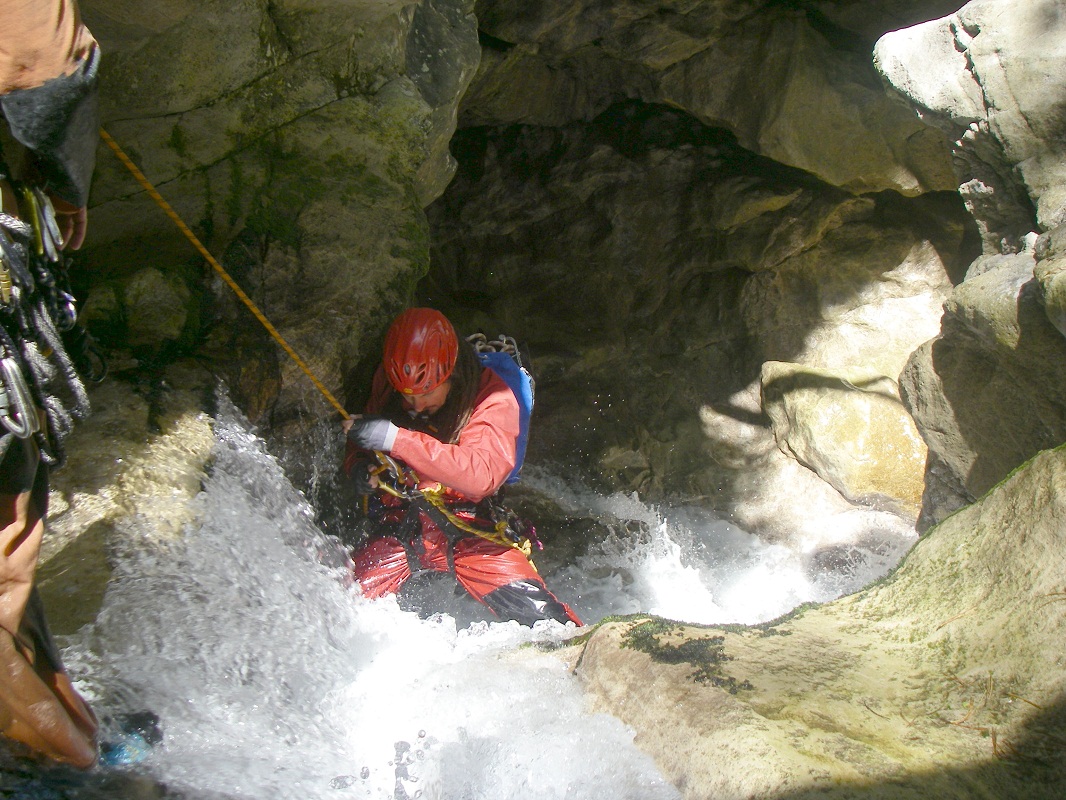
12 - MC + RB + P 12 R
13 - MC + RB + P 18 L
Exit:
Follow the river bed until a weir, by-pass with a footpath on the right bank (possible J 8).After the weir, take a path on the left bank that returns to the ford, from where you reach the road in 10 minutes.
Notes:
The catchment area of this river is very large, with many tributaries and runoff water that flood the canyon slowly (slow response time). For this
reason, it is important to descend this canyon only with stable weather, and after periods without rain; a sudden flood in the narrow section would
not allow escape.The most critical steps are the first two pitches of the second narrow passage, which are not by-passable and are under the water flow for almost their entire length.
The first narrow passage can be by-passed by the path in the woods on the right bank.
The first descent was made on 16/07/2010 by AG P.P. Pedrini, A. De Rovere and R. Del Fabbro.
URL:http://www.canyoneast.it
Layout, design & revisions © 2017, CanyonEast Canyoning Team - Seba Broili, Vanessa Johnston, Romy Siegl, Cristian Vogrig
Webmaster: uomonero@canyoneast.it - Revised - - 22/08/2017
Layout, design & revisions © 2017, CanyonEast Canyoning Team - Seba Broili, Vanessa Johnston, Romy Siegl, Cristian Vogrig
Webmaster: uomonero@canyoneast.it - Revised - - 22/08/2017


